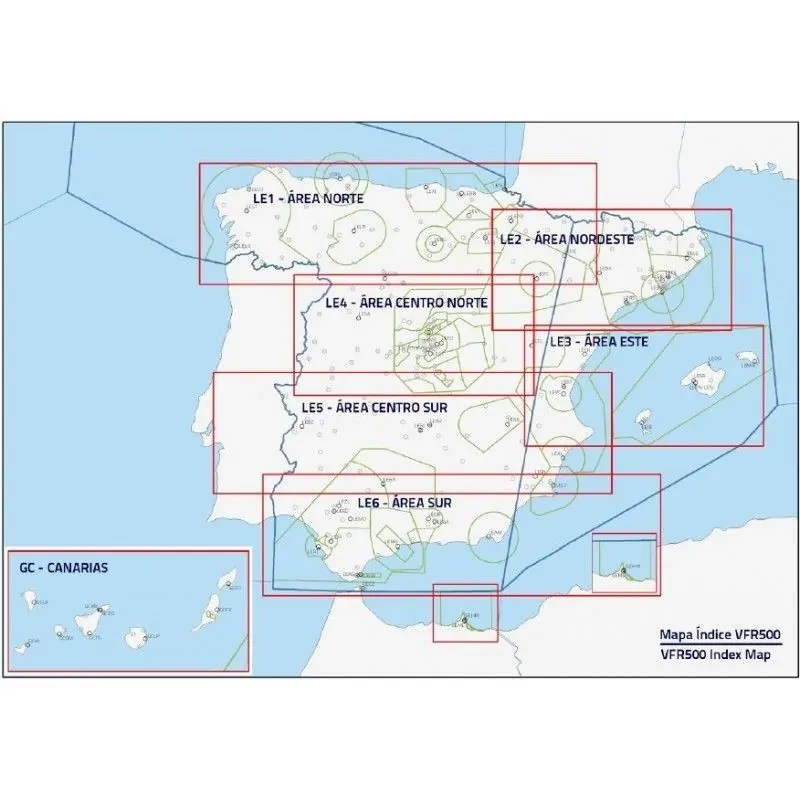

ICAO VFR500 Aeronautical Charts, produced by the Aeronautical Information Division at ENAIRe, complement the VFR Manual that contains the necessary information for Visual Flight Rules navigation en route. They comprise seven sheets* at 1:500.000 scale including all topographical and aeronautical data needed for flight planning and cover the entire territory of Spain.
*They may be purchased separately.
2024 Edition.
Content:
Reference systems:
Peninsula and Baleares charts (LE1 a LE6) use the following reference system:
Lambert Conformal Conic Projection
Parameters:
Canarias chart (GC) uses the following reference system:
Lambert Conformal Conic Projection
Parameters:
ICAO VFR500 Aeronautical Charts, produced by the Aeronautical Information Division at ENAIRe, complement the VFR Manual that contains the necessary information for Visual Flight Rules navigation en route. They comprise seven sheets* at 1:500.000 scale including all topographical and aeronautical data needed for flight planning and cover the entire territory of Spain.
*They may be purchased separately.
2024 Edition.